DJI Phantom 4 Pro camera vs. Sony A6000
Recently I flew a DJI Phantom 4 Pro v2 head to head with an in-house (U of MN AEM UAS Lab) developed fixed wing UAS. This comparison isn’t entirely apples to apples, but maybe someone will find it useful.
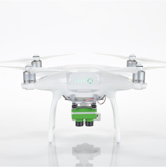
DJI is the king of the hill for small UAS aerial surveys. Once you figure out the apps and a few basic things, operating one of these is pretty much click and fly and makes aerial survey work about as easy as it can be. Some quick details of our system:
- Camera horizontal field of view: about 67 degrees.
- 20 Megapixel RGB sensor (4864 x 3648 pixels)
- At 400′ AGL the image would cover approximately 162 x 121 meters @ 3.3 cm per pixel.
- Useful mission flight time: approximately 20 minutes.
- Typical mission cruise speed 13 mph.
- Megapixels collected per mission: about 8000.
- Vertical take of and landing for operating in constrained areas: Yes!
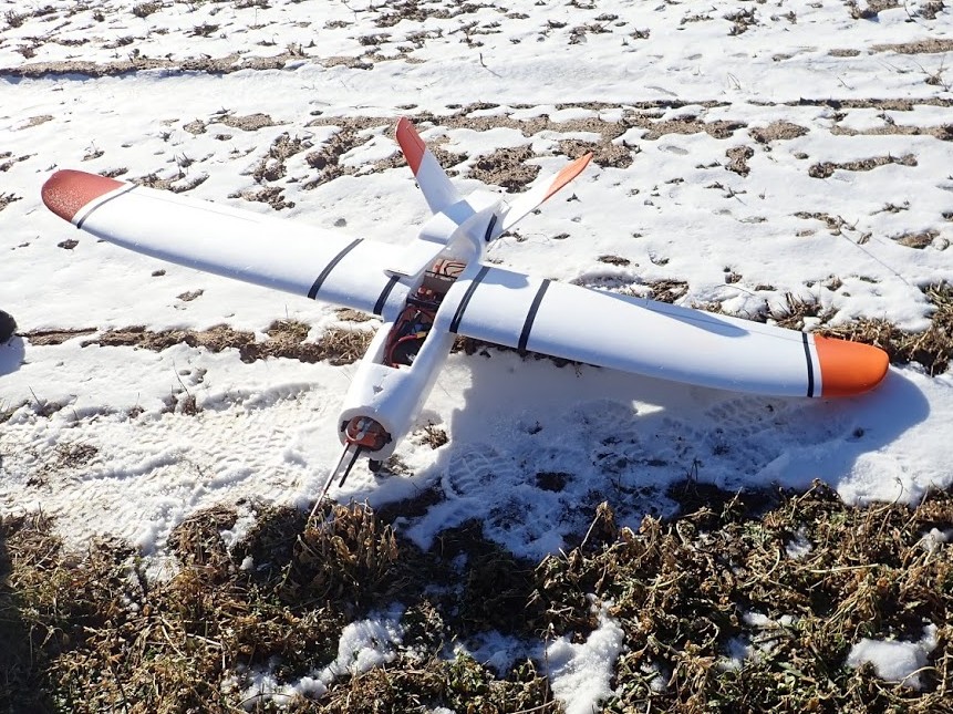
Our in-house fixed wing survey platform is a full size X-UAV Talon (with the 15 cm wing extensions.) The camera is a Sony A6000 with a 30mm prime lens.
- Camera horizontal field of view: about 43 degrees.
- 24 Megapixel RGB sensor (6000 x 4000 pixels)
- At 400′ AGL the image would cover approximagely 96 x 63 meters @ 1.6 cm per pixel.
- Useful mission flight time: approximately 75 minutes.
- Typical mission cruise speed 30 mph.
- Megapixels collected per mission: about 60,000 (7.5x more data than a DJI flight.)
- Operates out of constrained areas: No! (But the system has auto-launch and auto-land capabilities to minimize pilot workload during operations.)
- Side note: our in-house system flies with our in-house “Goldy3” autopilot flight controller.
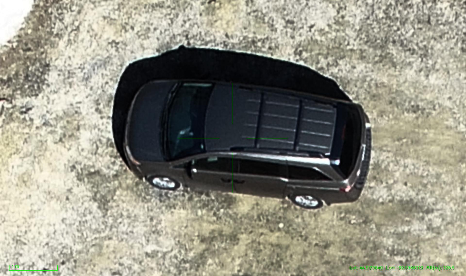
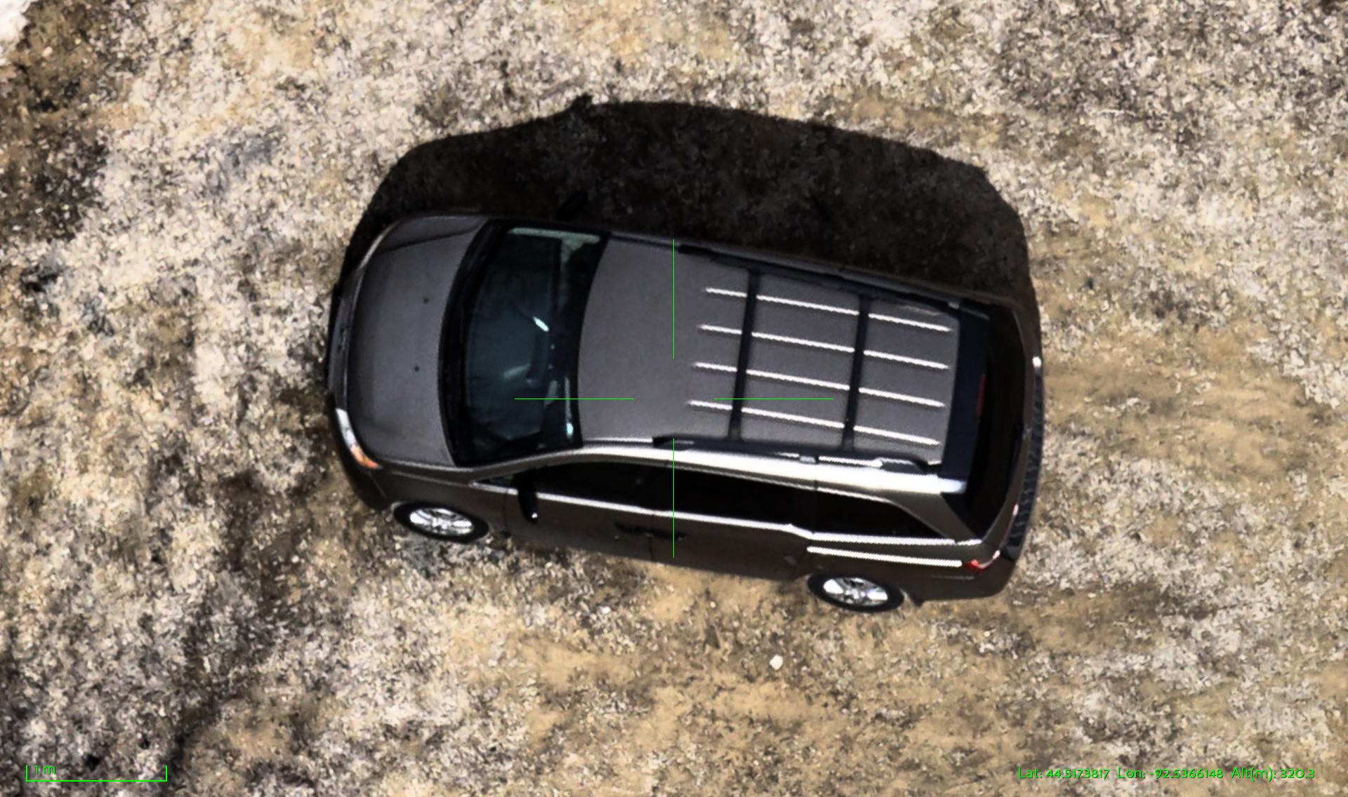
Recently we flew both of these systems over the same area for a head to head match up. We flew both systems at an altitude of 200′ AGL. If you look at the respective camera specs you will already know what to expect, but I wanted to share the head to head imagery.
The Sony A6000 yields approximately double the pixel resolution at the same altitude (4x the pixels for any area.) In addition, the Sony imaging sensor has about 3x the area compared to the DJI imaging sensor. You can see much better pixel detail in the Sony images as well as more subtle color variations, less washout (saturation), richer colors, and fewer compression artifacts when you zoom way in. So with all that said, here are the image snippets for direct comparison.
Side by side comparison
Hint: For best image pair viewing results: right-click on each image and select “open in new window”. Then drag the windows so you can see the images side by side. You may be able to click in each new window to expand the size to full resolution. If you are reading this on your phone, then I’m sorry!
Van: look for subtle things like the windshield washer nozzles, the wheel rim pattern, gravel pattern.
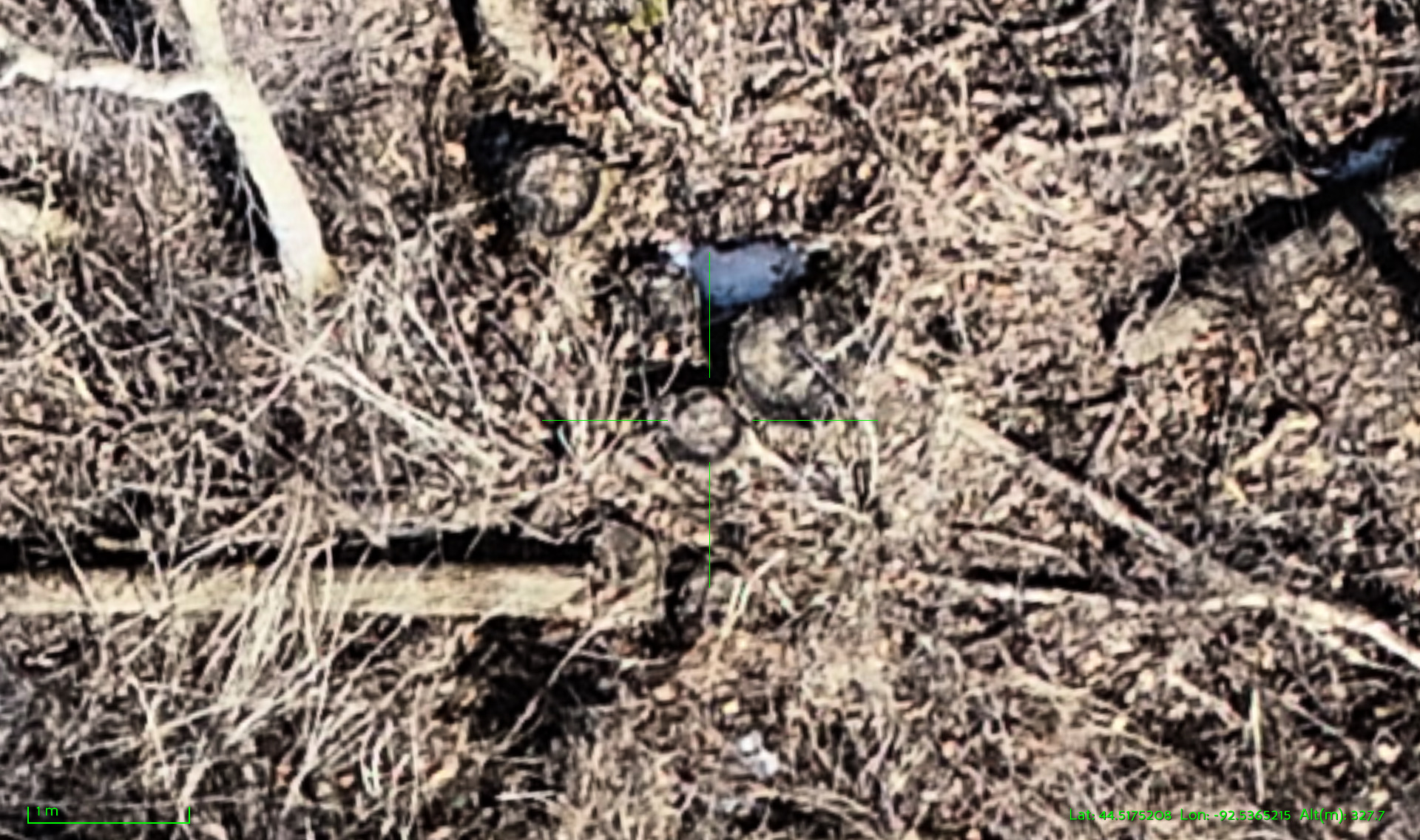
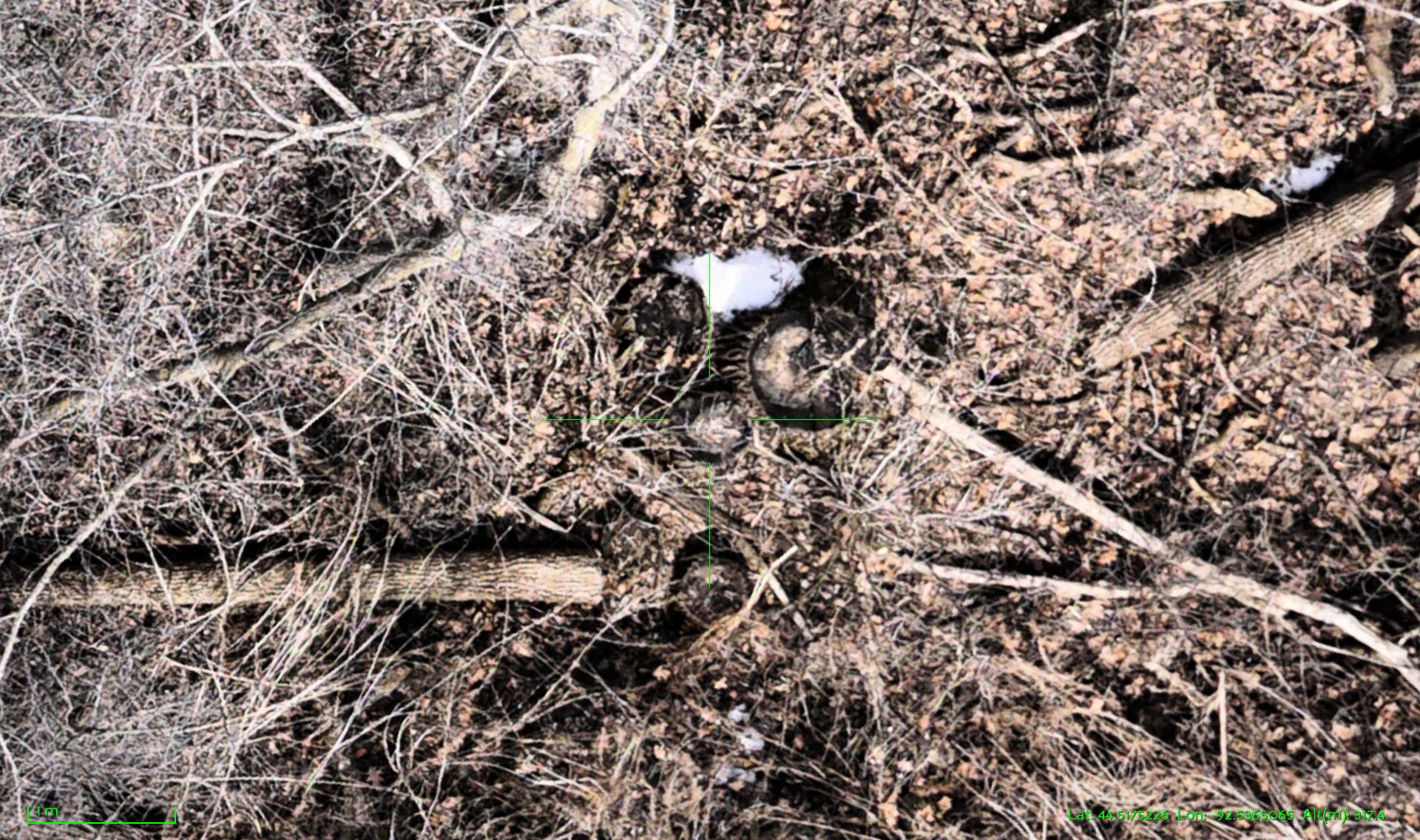
Stumps: notice the overall details, you can see bark patterns in the sony image.
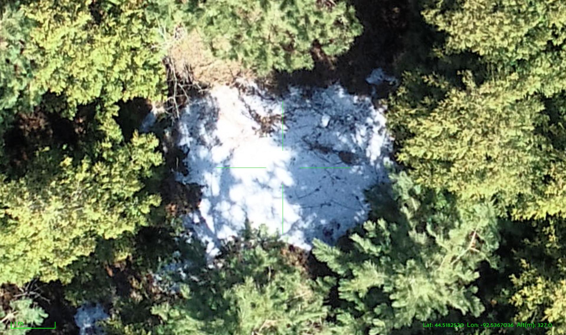
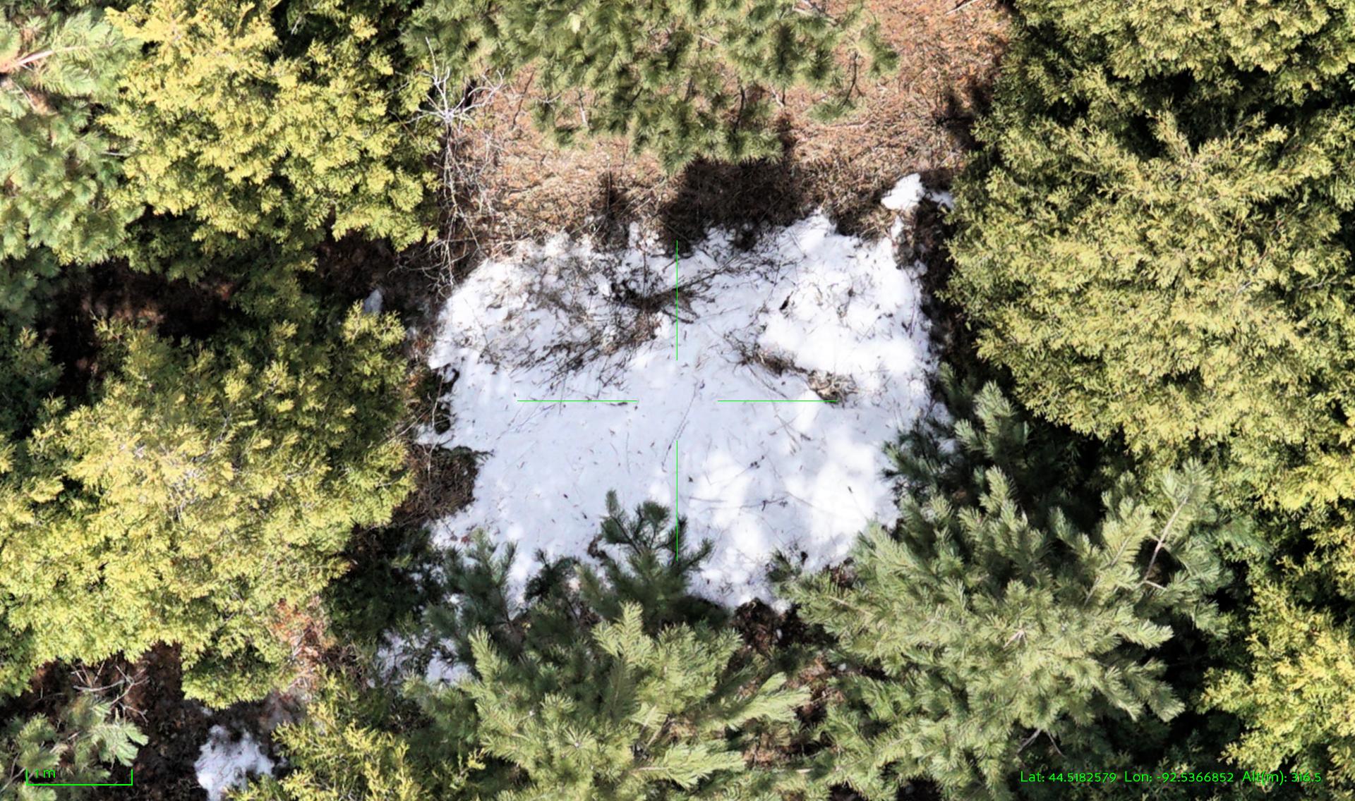
Evergreens and snow patch: see how the subtle details are preserved in the snow patch better with the Sony camera and individual pine needles are clearly visible.
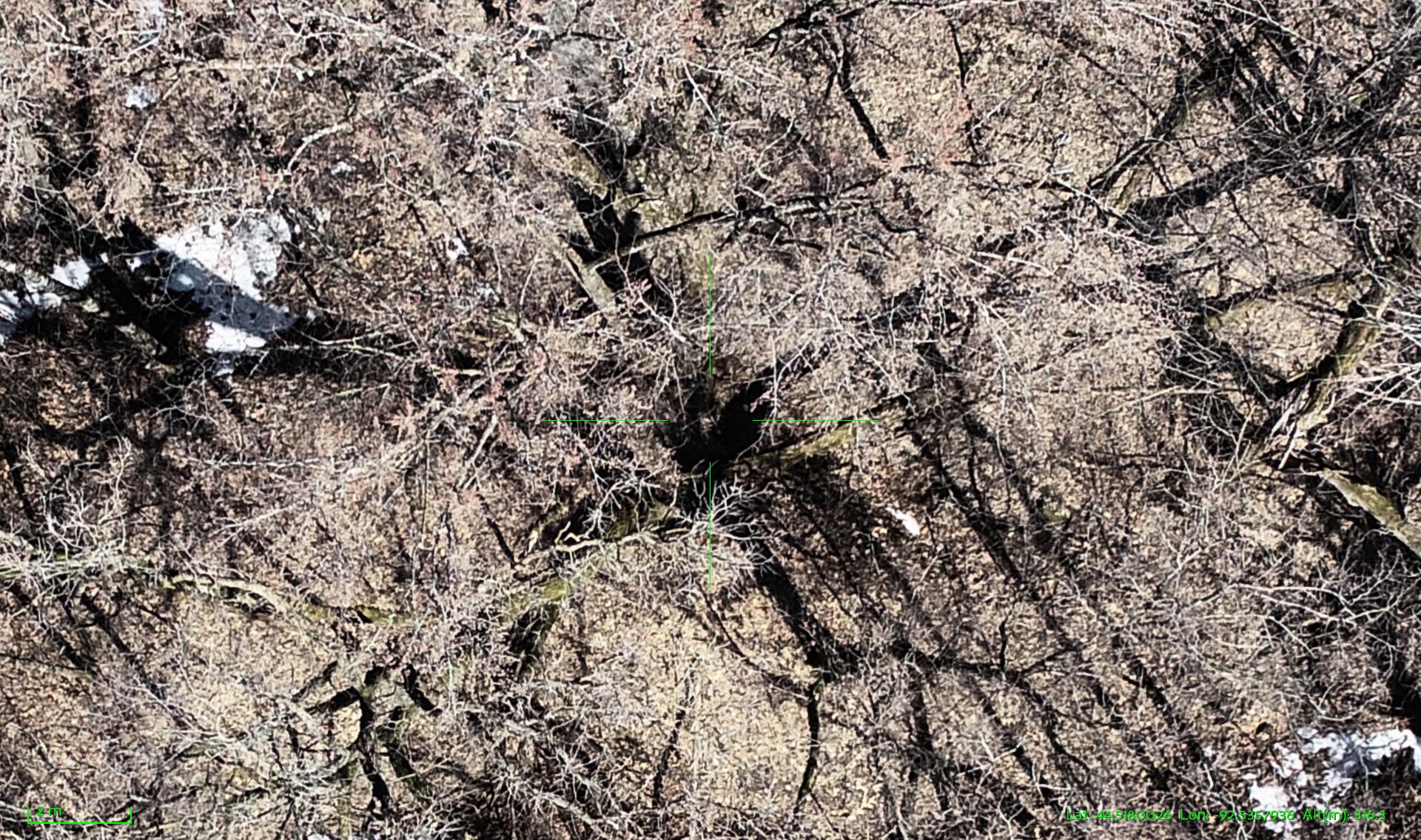
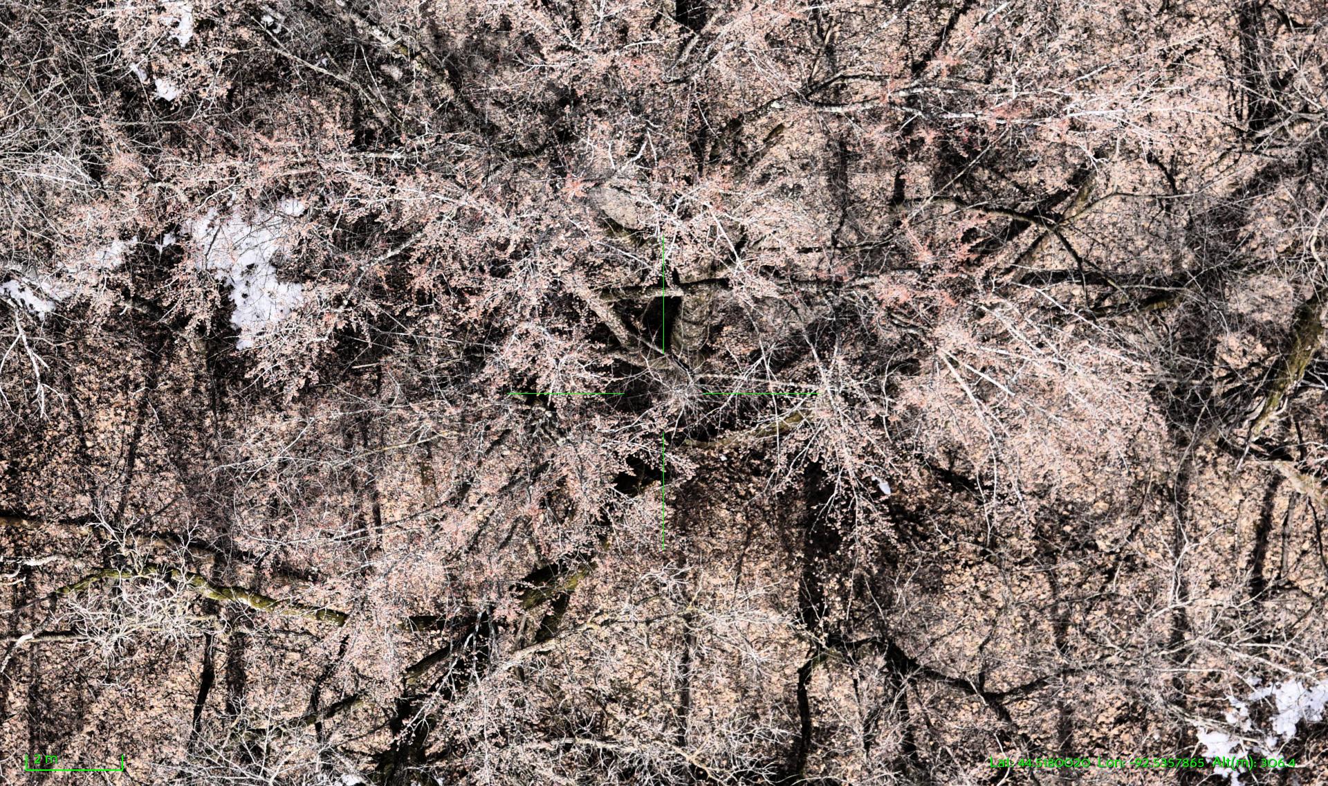
Spring buds: notice the details in the fine branching structures and the new buds on all the branches. This is a pair of images that also show the extra jpg compression artifacts in the DJI images.
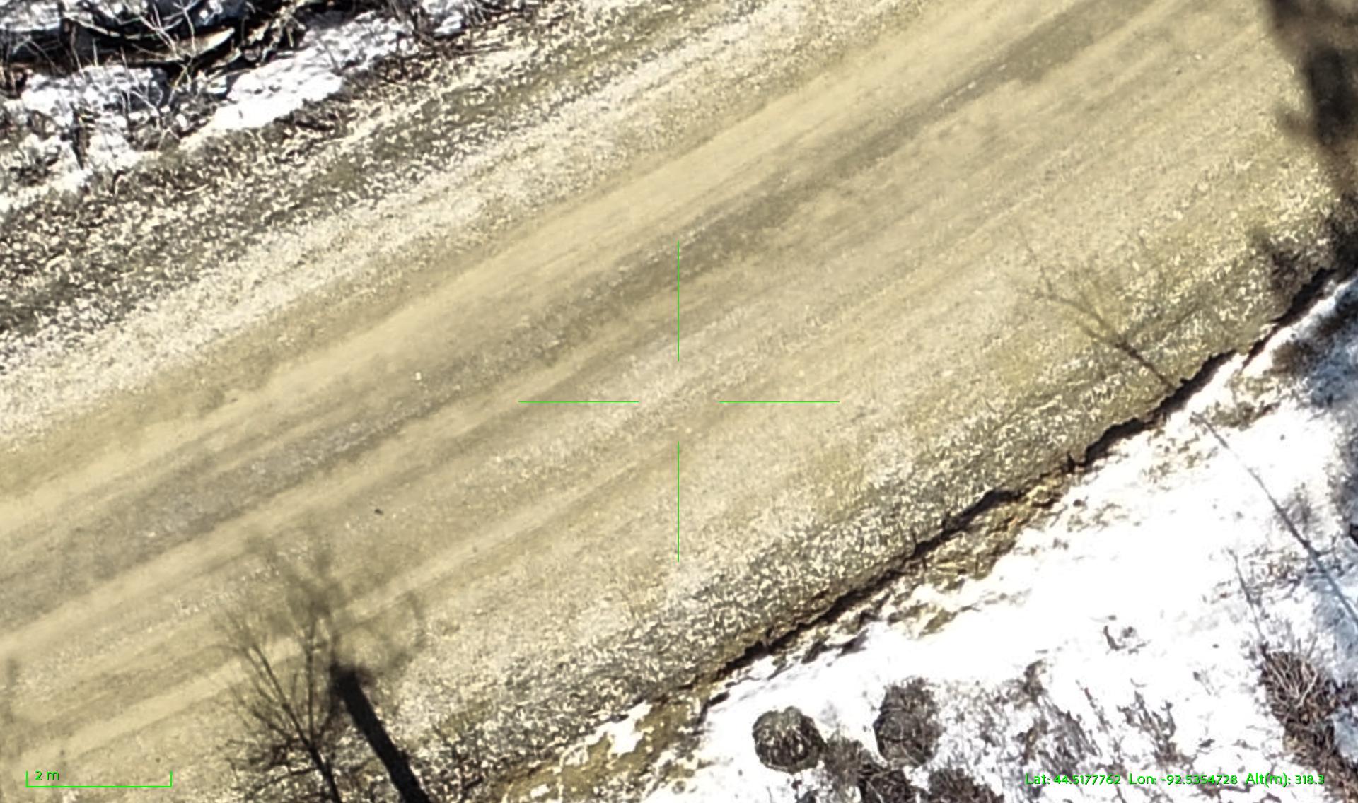
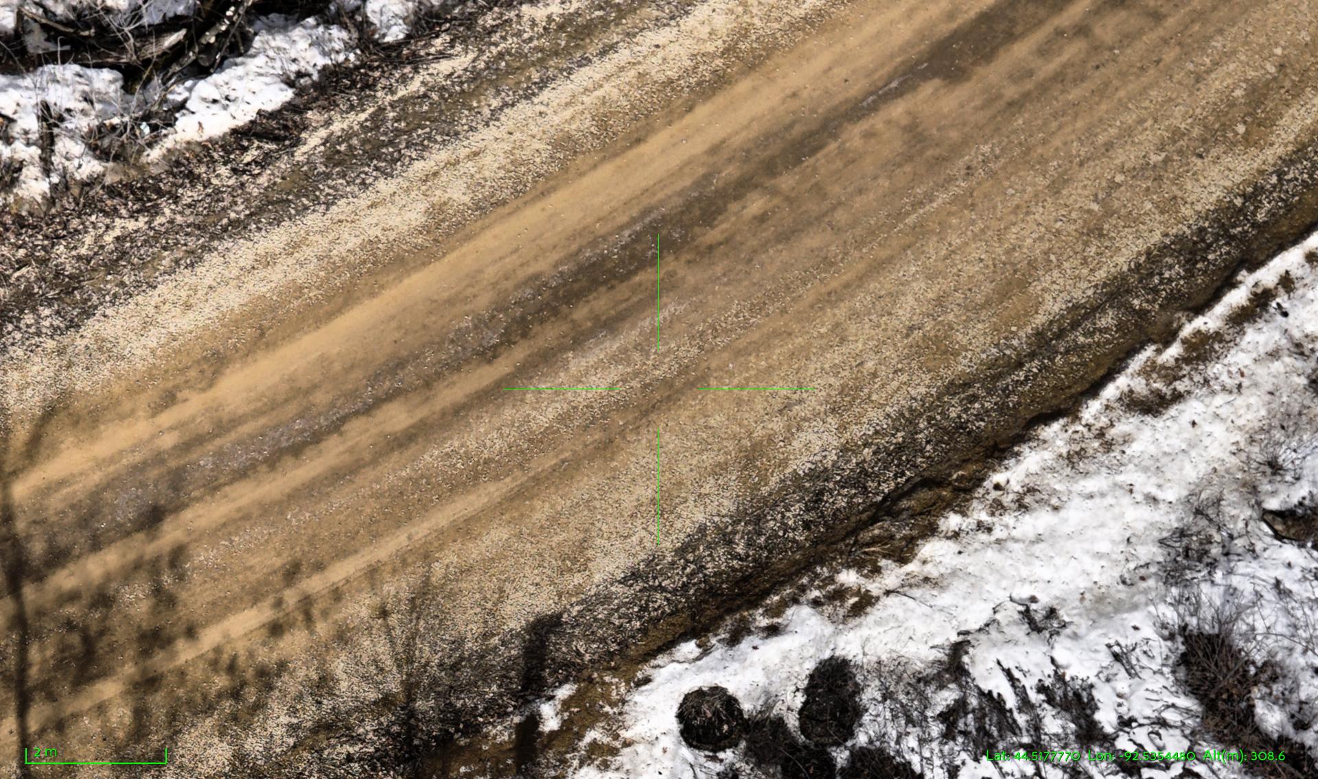
Gravel road: notice the richer colors in the Sony image, notice the subtle details in the snow patch (the DJI image gets totally washed out in the snow area) and notice the overall sharper detail in the gravel. And again you can see where the extra jpg compression on the DJI image limits how much you can usefully zoom in.
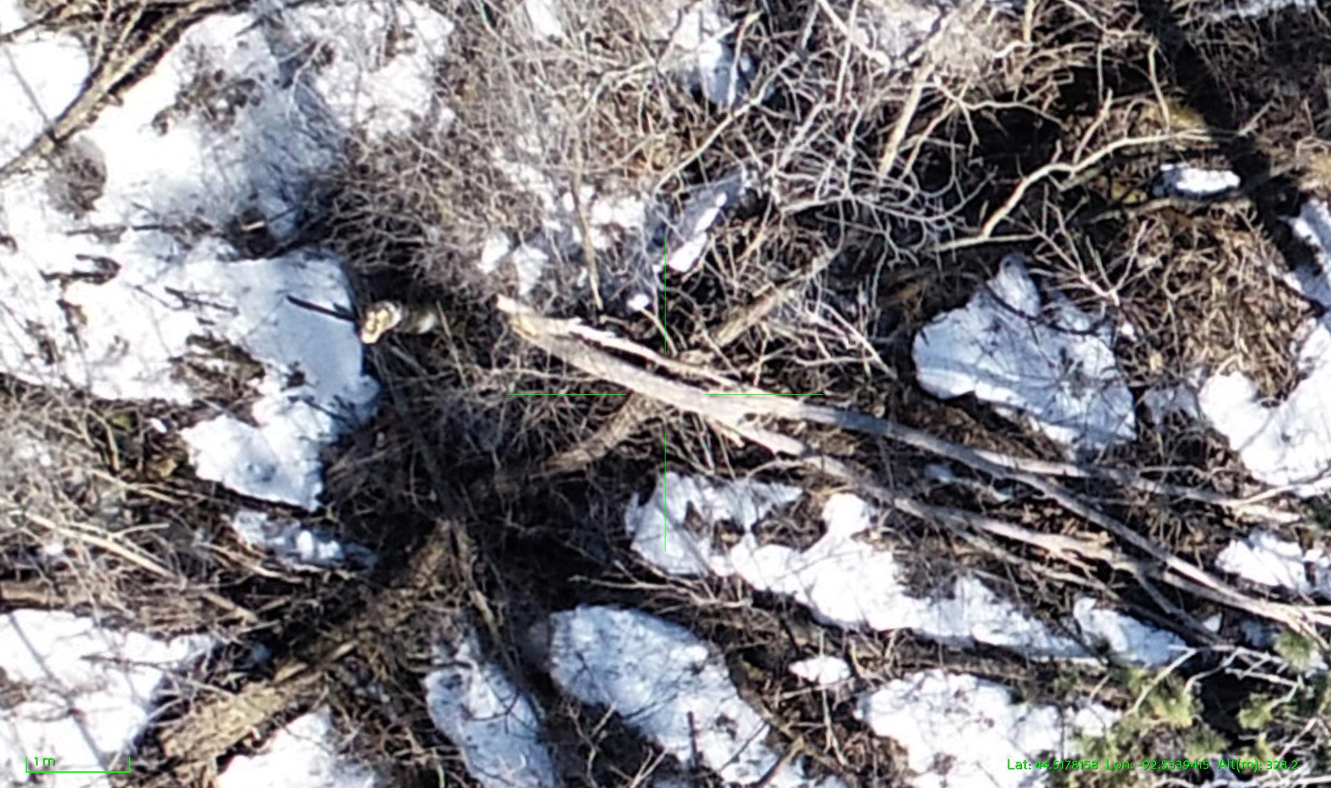
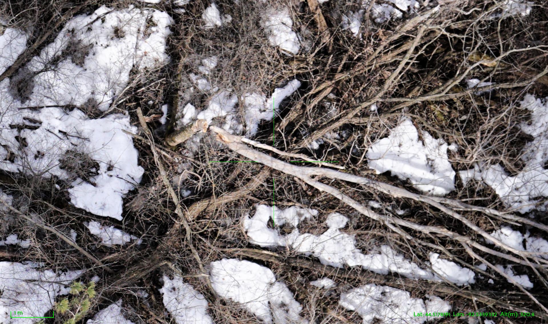
Pile of branches: look for the detail in the bark pattern, the shading detail in the snow patches, the detail vs. compression artifacts in the tiny branches.
Conclusion
This is a comparison of two systems (the Phantom 4 is popular commercial system vs. our U of MN UAS Lab in-house built fixed wing system) both flying at 200′ AGL. This is not a perfect apples to apples comparison and it may not be representative of your own typical use cases. What I have shown here is that a higher quality camera produces better pictures (duh!) For some types of missions the details and the image quality do matter!
Thanks for reading!